
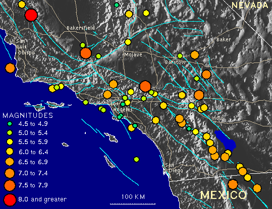
 Distribution of Ridgecrest Earthquakes 1980-1995
Northridge Sequence January-July 1994
Landers/Big Bear Sequence June 28, 1992
Hector Mine - October 16, 1999
Additional reports and animations
PROBABILITY OF AN AFTERSHOCK ONE UNIT OF MAGNITUDE SMALLER,
PROBABILITY OF A LARGER EARTHQUAKE AT THE SAME PLACE
Within one hour: 1.5% - Within three days: 6%
PROBABILITY OF AN EARTHQUAKE ONE UNIT OF MAGNITUDE LARGER
(e.g. a
M6 mainshock to a M5 foreshock at the same place)
Within three days: 1%
PROBABILITIES OF A FUTURE LARGE EARTHQUAKE ARE HIGHER NEAR A FAULT
LARGE ENOUGH TO PRODUCE A BIG EARTHQUAKE (e.g. the San Andreas)
Probability of a M7.5 earthquake in the three days after
a M6
in the southern Coachella Valley: 30%
Lavic Lake-Hector Mine Earthquake - 10/16/1999 M7.1 |
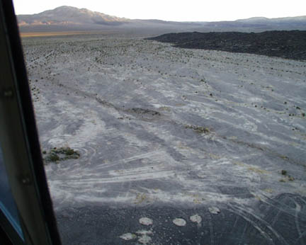 |
HECTOR MINE QUAKE

TIME: October 16, 1999; 2:46am PDT LOCATION: 34° 36' N, 116° 16' W; 32 miles north of the town of Joshua Tree 47 miles east-southeast of Barstow MAGNITUDE: Mw 7.1 TYPE OF FAULTING: right-lateral strike-slip |
|
Pictures taken by Paul "Kip" Otis-Diehl, USMC, 29 Palms are available at this link. Southern California Earthquake Data Center information on The Hector Mine Earthquake. For further information on the Hector earthquake and the Lavic Lake fault, see the U.S. Geological Survey Pasadena Office web site . |
Commentary can be found at Trinet. Charles Watson's Seismo-Watch Special Earthquake Report has some great Photos of the fault site.
|
Northridge - January 17, 1994 - Magnitude 6.7 |
 | NORTHRIDGE EARTHQUAKE
TIME: January 17, 1994; 4:31 AM PST LOCATION: 34 degs 12.53' N, 118 degs 32.44'W, 20 miles west-northwest of Los Angeles; 1 mile south - southwest of Northridge. MAGNITUDE: Mw 6.7 TYPE OF FAULTING: blind thrust |
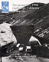 | The January 17, 1994 Northridge, CA Earthquake An EQE Summary Report - March 1994 (Click to view this report) Executive Summary Geology and Seismology Commercial Structures Industrial Facilities Electric Power Facilities Transportation Other Lifelines Residential Buildings Fire Following Earthquake |
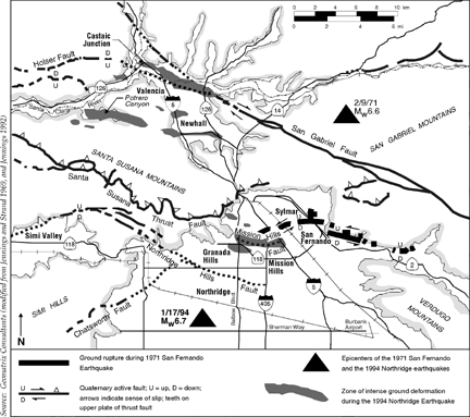 Epicenters & Faults Sylmar 1971 & Northridge 1994 | 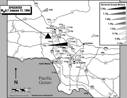 Accelerated Ground Movement Northridge 1994 |
Landers / Big Bear - June 28, 1992 - Magnitude 7.3 |
 Click on image to view | LANDERS EARTHQUAKE
TIME: June 28, 1992; 4:52 AM PST LOCATION: 34 degs 13' N, 116 degs 26'W, 6 miles north of Yucca Valley. MAGNITUDE: Mw 7.3 RUPTURE LENGTH: 85 km (~53 miles) AVERAGE SLIP: ~3 to 4 km; Maximum slip - 6 meters FAULTS RUPTURED: Johnson Valley, Landers, Homestead Valley, Emerson, and Camp Rock TYPE OF FAULTING: right-lateral strike slip View Slides, Rupture Movie, and Aftershock Animation |
 Epicenter Map |
VIEW the EQE Report on the Landers / Big Bear Earthquake |
Loma Prieta - October 17, 1989 - Magnitude 7.1 |
 | The October 17, 1989 Loma Prieta, CA Earthquake An EQE Summary Report - October 1989 (Click to view this report) Introduction Geology and Seismology Commercial Structures Industrial Facilities Lifelines Transportation Residential Structures Fire Following Earthquake Conclusions |


 to Susan Rosenberg's Quaking Home Page
 Web Site Index